PLSS Section
Look up a Public Land Survey System (PLSS) section corner from the BLM GIS database. The app retrieves the official coordinates for township, range, and section corners and places them directly on the map — no GPS anchor required.
Tap + and choose PLSS
From the main plat list, tap + and select the PLSS tab.
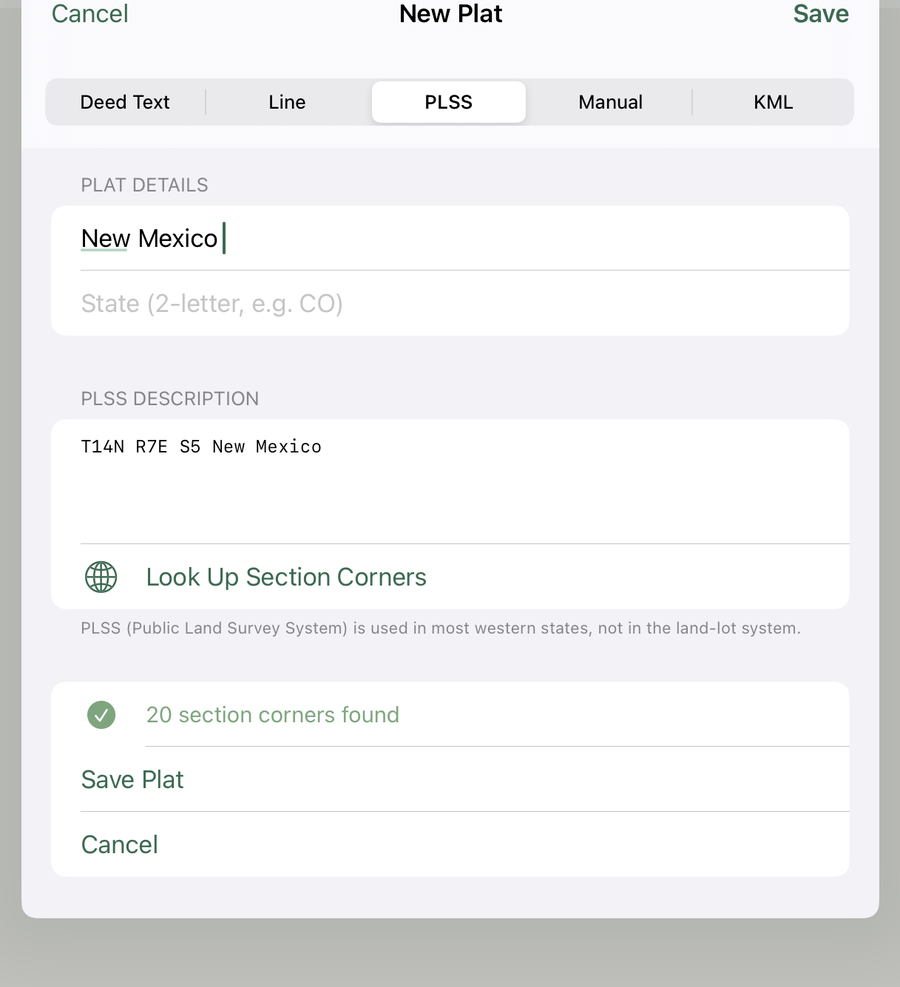
Enter township, range, and section
Enter the Principal Meridian, Township (e.g. T3N), Range (e.g. R5E), and Section number. These are found on your deed, plat map, or county records.
| What to type | Meridian | State / Area |
|---|---|---|
| T7S R21E S33 Mt. Diablo | Mt. Diablo (MDBM) | CA — Sierra Nevada foothills |
| T31N R1E S32 Mt. Diablo | Mt. Diablo (MDBM) | CA — northern California (Siskiyou Co.) |
| T4N R3W S9 Willamette | Willamette (WM) | OR — northwest of Portland |
| T41N R7E S31, Willamette, WA | Willamette (WM) | WA — northeastern WA (Willamette covers OR & WA) |
| T17S R4W S22 WM | Willamette (WM) | OR — Lane County / Eugene area |
| T3N R2E S18 Boise | Boise (BM) | ID — Ada County / Treasure Valley |
| T1N R8E S1 Montana | Montana PM | MT — central Montana |
| T14N R7E S5 New Mexico | New Mexico (NMMPM) | NM — north-central NM |
| T5N R2E S30, 6th PM, NE | 6th Principal — Nebraska | NE — include state for 6th PM |
| T3S R68W S14, 6th PM, CO | 6th Principal — Colorado | CO — include state for 6th PM |
| T79N R6W S12, 5th PM, IA | 5th Principal — Iowa | IA — include state for 5th PM |
Tap Look Up
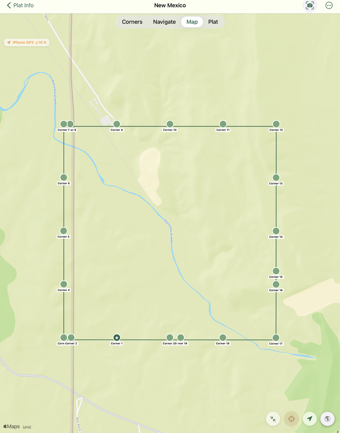
Tap Look Up to query the BLM database. The app retrieves the section corner coordinates and displays a preview on the map.
Save the plat
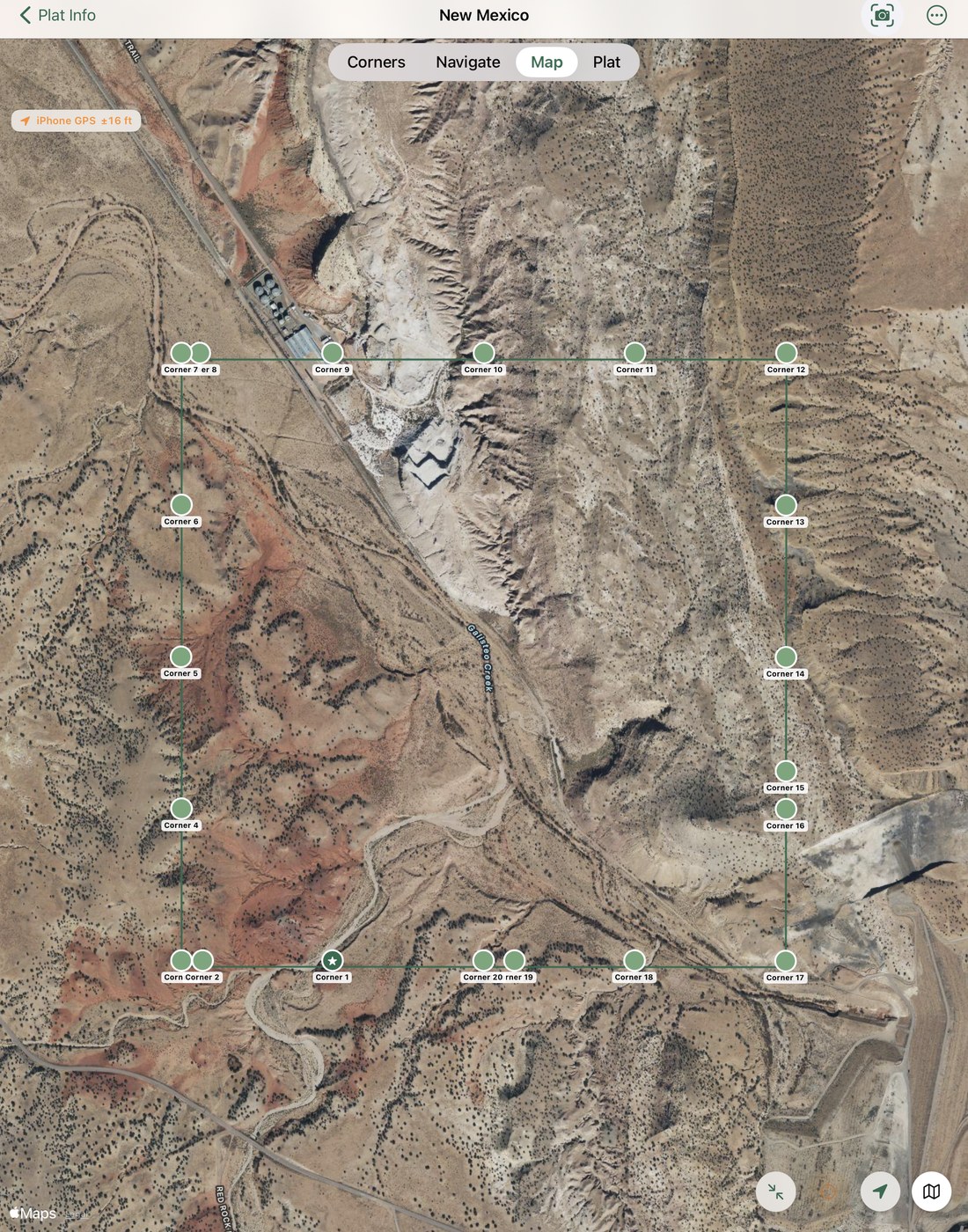
Name the plat and tap Save. Because PLSS corners have absolute coordinates from the BLM database, the corners are placed on the map immediately — no GPS anchor step needed.
Quarter Sections & Smaller Parcels (Aliquot Parts)
Most rural PLSS parcels aren't a full 640-acre section — they're described as a fraction of one, using language like "the NE¼ of Section 14" (a 160-acre quarter section) or "the NE¼ of the NW¼ of Section 14" (a 40-acre quarter-quarter). GPS Stakeout reads these directly: type the aliquot part right into the same field as the township, range, and section — e.g. NE¼ NE¼ NE¼ of Section 14, T5N R3E for a 10-acre citation (up to three quarter-levels are recognized, spelled out or abbreviated).
Meridian name reference
The app accepts both named meridians and numbered meridians. Use any of these forms in your description — the parser recognizes all of them.
| Meridian | States | Accepted input forms |
|---|---|---|
| Mount Diablo | CA, NV | Mt. Diablo · Mount Diablo · MDBM |
| Willamette | OR, WA | Willamette · WM · 27th PM |
| Boise | ID, MT, UT, WY | Boise · 4th PM |
| Montana | MT | Montana · 20th PM |
| New Mexico | NM, CO | New Mexico · NMMPM · 22nd PM |
| 6th Principal | CO, KS, NE, WY | 6th PM · 6 PM |
| 5th Principal | AR, IA, MN, MO, ND, SD | 5th PM · 5 PM |
| Salt Lake | UT | Salt Lake · 31st PM |
| Gila & Salt River | AZ | Gila · Salt River · 2nd PM |
| Black Hills | SD | Black Hills · 9th PM |
| Wind River | WY | Wind River · 28th PM |
GPS anchoring on PLSS plats
Because PLSS corners have coordinates from the BLM database the moment you save them, PLSS plats behave differently from deed-text plats in several important ways.
BLM coordinates are permanent
When you save a PLSS plat, the app stores two sets of coordinates: the BLM reference position (permanent, from the federal database) and the field position (updated if you GPS-anchor in the field). The BLM reference is never overwritten — it's the authoritative position for each section corner.
Reset to BLM Position
In the Plat Info tab, a Reset to BLM Position button replaces the "Clear GPS positions" button for PLSS plats. Tapping it restores all corners to their original BLM-surveyed coordinates, discarding any field adjustments. Use this if you accidentally anchored the plat at the wrong location.
Proximity guard
If you tap Set as Reference (I'm Here) while your GPS position is more than 1,000 feet from the BLM-recorded location of that corner, the app shows an alert with the distance and asks you to confirm. This prevents accidentally shifting the entire section boundary to the wrong state or county. You can tap Anchor Anyway if you have a legitimate reason (for example, you know the BLM data for that area is offset).
Navigate Here doesn't auto-anchor
On deed-text plats, tapping Navigate Here automatically re-anchors the plat to your current GPS position before switching to the Navigate tab. On PLSS plats this auto-anchor is suppressed — the BLM coordinates are already accurate and re-anchoring to your current location would move the boundary away from its surveyed position.