GPS Stakeout  ·  Docs
Using the App

Navigate to a Corner

Once a plat is anchored, navigate to any corner with real-time distance and bearing updates. The app guides you directly to the corner as you walk.

Free vs Pro. The free tier lets you navigate to 3 corners per plat. Navigating to every corner is included with the one-time Pro upgrade — see Free & Pro.
1

Open the Corners tab

Inside a plat, tap the Corners tab. All boundary corners are listed with their computed coordinates and distance from your current position. Tap any corner to see its options.
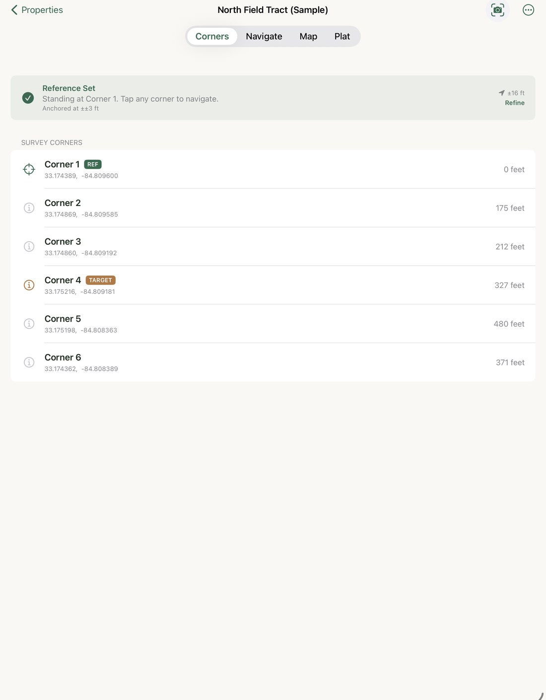
Corners tab listing Survey Corners — Corner 1 through Corner 4, each with an info button
2

Select a corner and tap Navigate

Tap any corner in the list, then tap Navigate. The navigation screen opens and immediately begins showing distance and bearing to the selected corner.
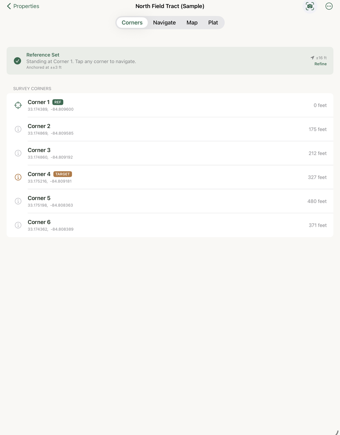
Corners list showing all corners after reference is set
3

Walk toward the corner

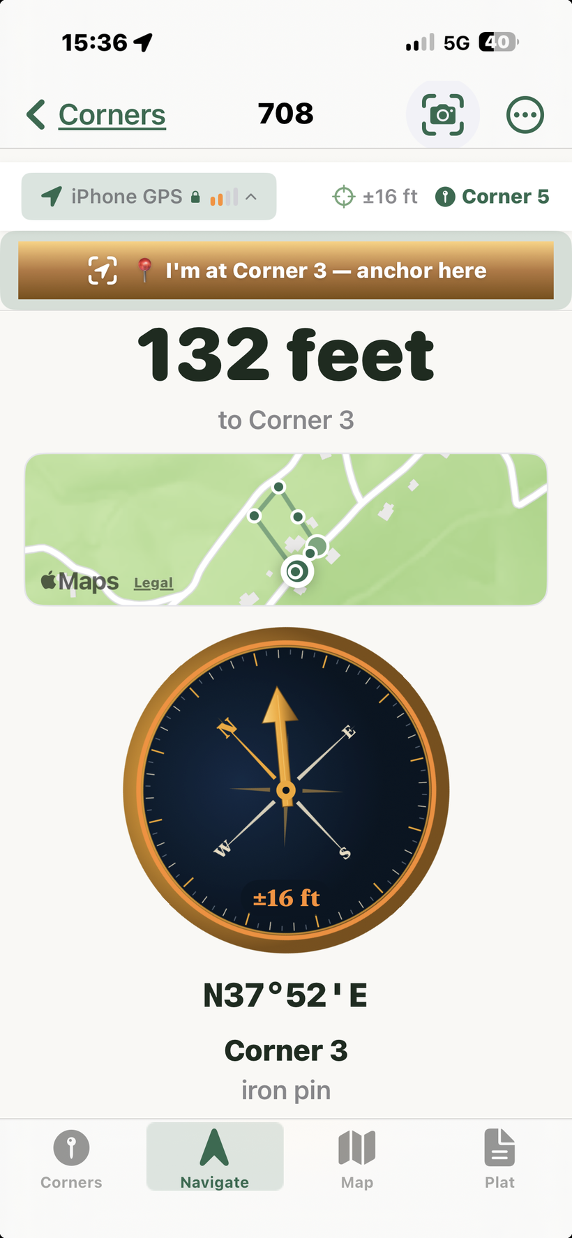
A vintage-style compass shows a copper pointer aimed at the corner, with the distance remaining above it (in feet when close, switching to miles when over 1 mile away — or meters and kilometers if you set Settings → Units to metric). Walk the way the pointer points; both it and the distance update continuously as you move. A colored confidence ring around the dial and an engraved “±ft” reading show, at a glance, how much to trust the fix.
Tip: Keep moving for a moment when you first open navigation. GPS bearing calculations require a small amount of movement to establish direction.
Navigate screen showing 132 feet to Corner 3 with a vintage compass, copper pointer, amber confidence ring, and engraved ±16 ft reading
4

Arrive at the corner

As distance drops below a few feet, slow down and let the GPS settle. When you're within 10 feet the display switches to a checkmark and "You've arrived" — that's your cue to stop walking and probe for the corner monument. You'll also feel a haptic pulse the moment you cross inside 10 feet, so you get the arrival cue without looking at the screen. It fires once per approach and resets if you step back out, so re-approaching the same corner buzzes again.
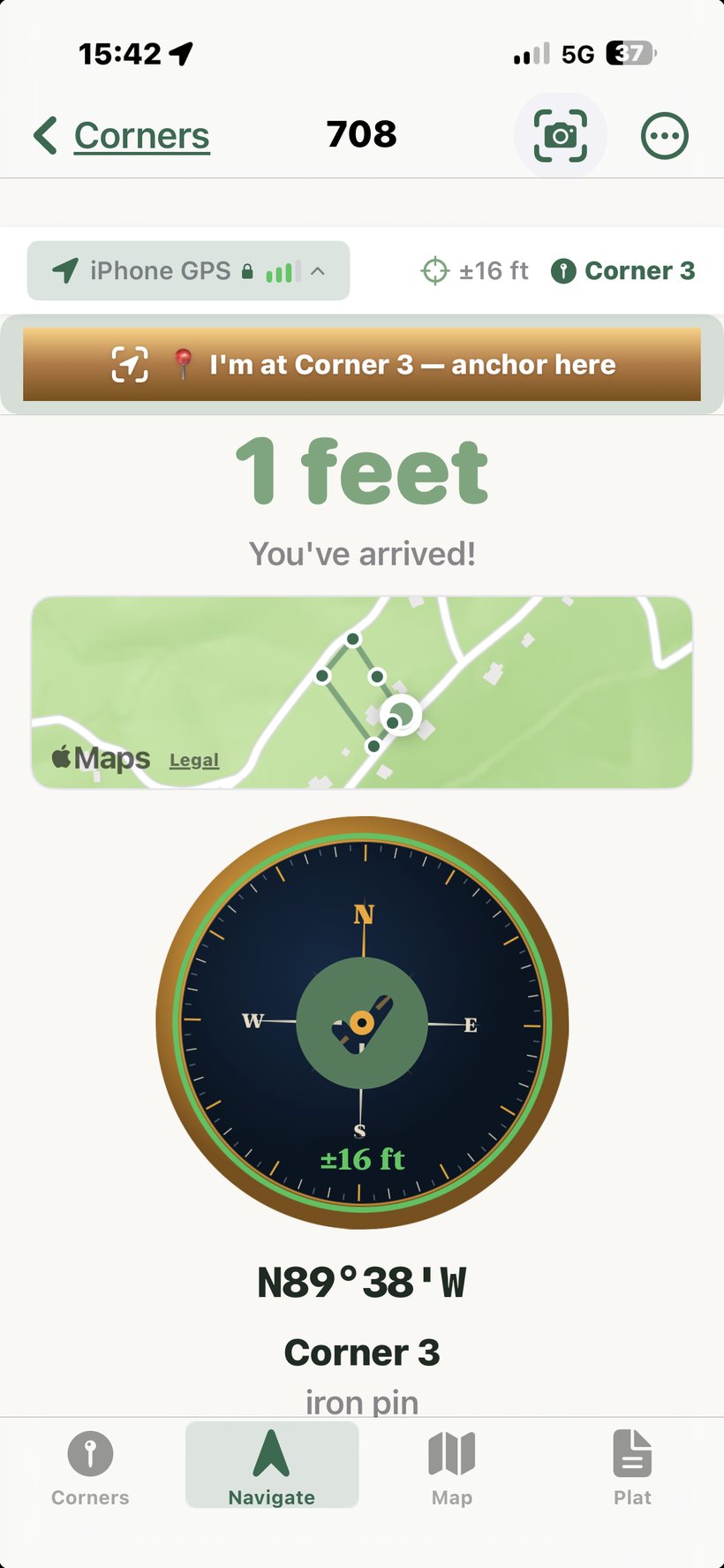
Navigate tab showing You've arrived! at Corner 3 — 1 foot, a green confidence ring around the compass with a checkmark, iPhone GPS ±16 ft
Final approach technique. The pointer is most reliable from about 100 ft down to 25 ft. Inside 25 ft, GPS bearing noise can exceed the actual signal — the pointer may wander even if you're standing still. At that point, shift your attention from the pointer to the distance number. Walk slowly, pause for a few seconds, and watch the number settle. When it reads 3–5 feet and stops changing, you're at the corner — mark it, probe for the pin, or flag it. Don't keep chasing the pointer once you're that close.

With an external GPS receiver like the XGPS160, the pointer stays reliable down to about 5 feet, significantly narrowing the "use distance only" zone.
Read the confidence ring before you conclude anything. The ring around the compass and the engraved “±ft” are color-coded — green is trustworthy, amber/red means wait. If it's Fair or Low, the reading is unreliable, not necessarily the boundary. And if the distance counts down while you stand still, the receiver is simply settling. Resist the urge to "fix" a short reading by tapping I'm at this corner: on an already-placed corner that slides the entire boundary onto a fix you already have reason to distrust. See Accuracy & Anchoring.
If the whole parcel plots rotated — near corners fit but far ones drift — the deed's bearing basis probably differs from true north (common on older magnetic-north deeds). Set it under ⋯ → Bearing Basis (True, Grid, Magnetic, or Assumed; for Magnetic, tap "Use compass"). Or, to fix it from the ground, anchor two known corners, then in that same sheet tap Solve rotation from these corners — an optional manual step for a genuinely rotated deed. If corners already land on the stakes from one anchor, leave it alone. See Understanding Survey Systems.

On iPad

The compass is size-adaptive. On iPad's larger screen it grows into a full instrument — a graduated degree ring, an 8-point rose, and cardinal and ordinal letters — while keeping the same copper pointer, confidence ring, and engraved “±ft” reading. Everything else on the Navigate screen (distance, mini-map, bearing) scales to match.
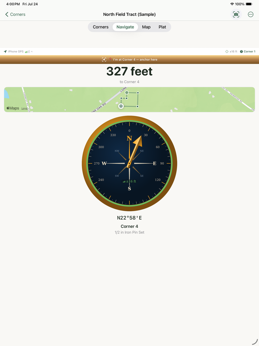
iPad Navigate screen with a large vintage surveyor's compass — graduated degree ring, compass rose, green confidence ring, copper pointer aimed at N22°58'E, and an engraved ±16 ft reading